
The Route
what3words for start point: ///tubes.tags.hillsides
Start Point: Tourist Information Car Park, Ingleton, North Yorkshire, LA6 3EB
Finish Point: Same as start point (circular walk)
Distance: Approximately 6 miles (9.6 kilometres)
Walk Description
Starting Point: Tourist Information Car Park, Ingleton, North Yorkshire, LA6 3EB
Key Highlights:
- Storr's Common: Begin your walk leaving Ingleton via Storr's Common, a picturesque area typical of the Dales.
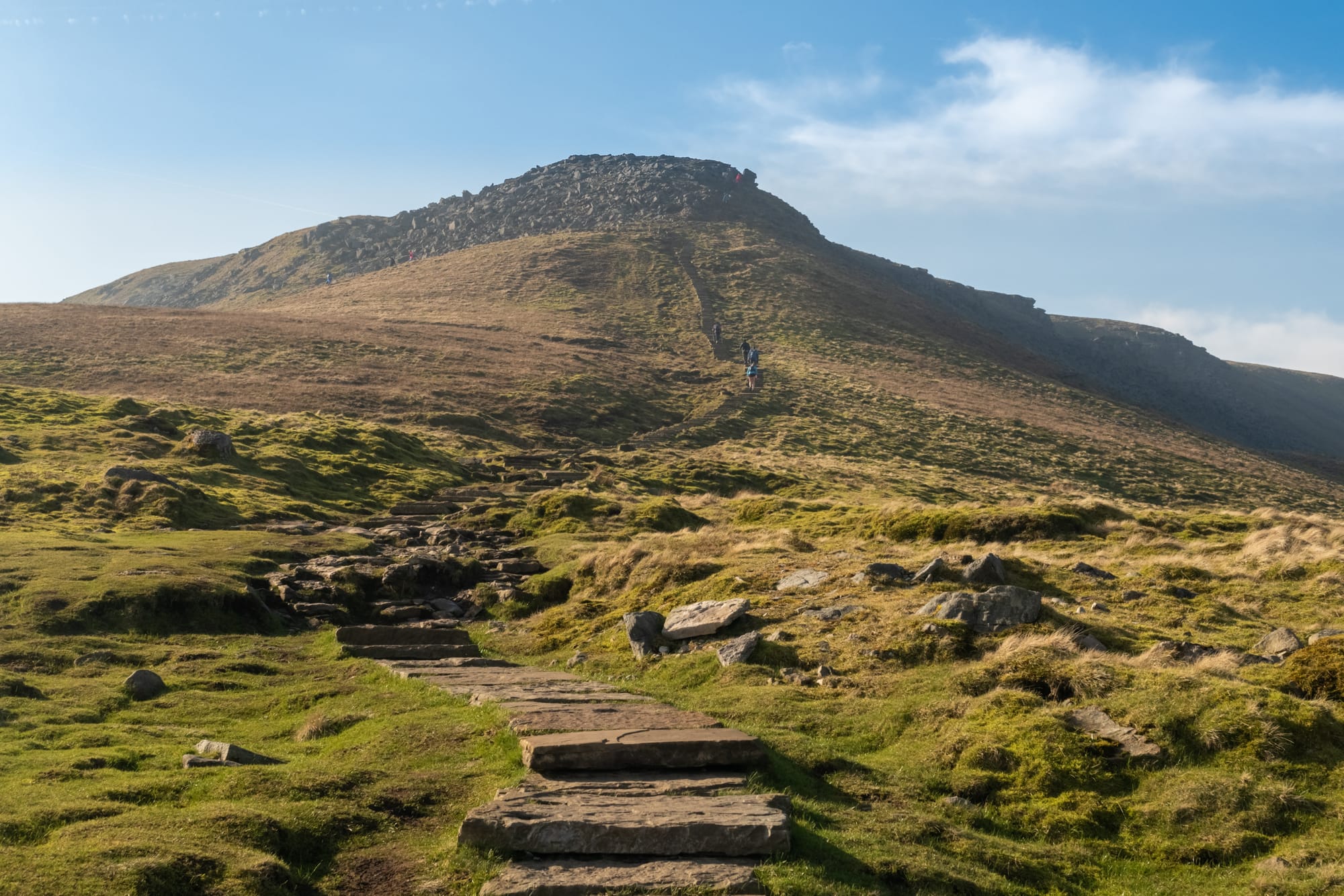
- Crina Bottom: A scenic spot known for its photographic opportunities, marking the start of the steeper ascent.
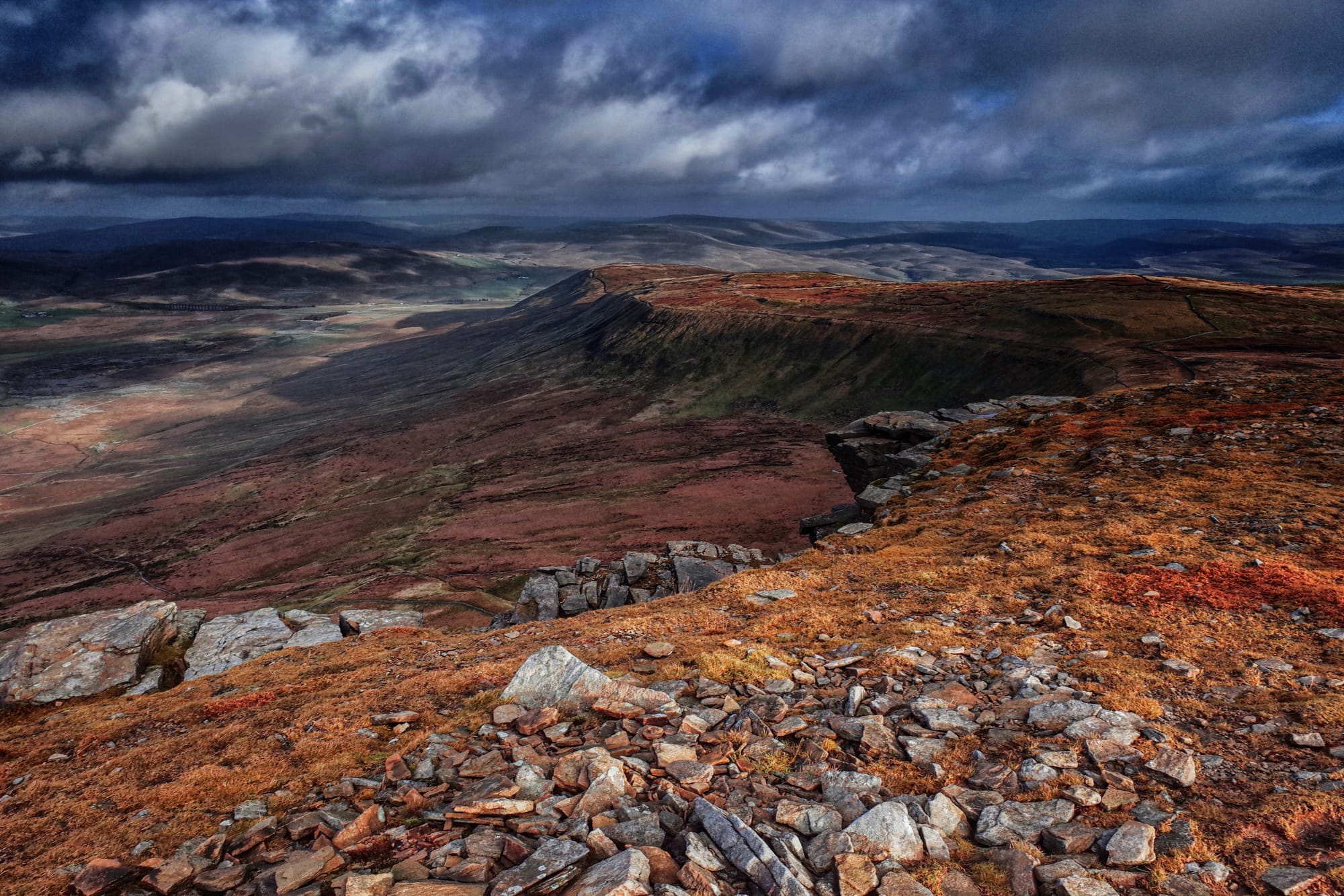
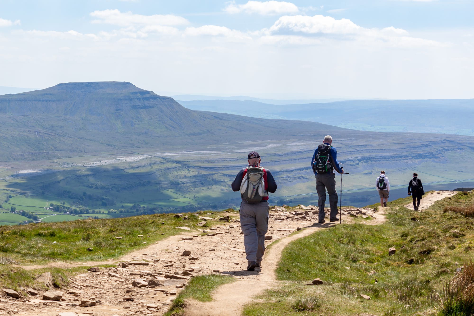
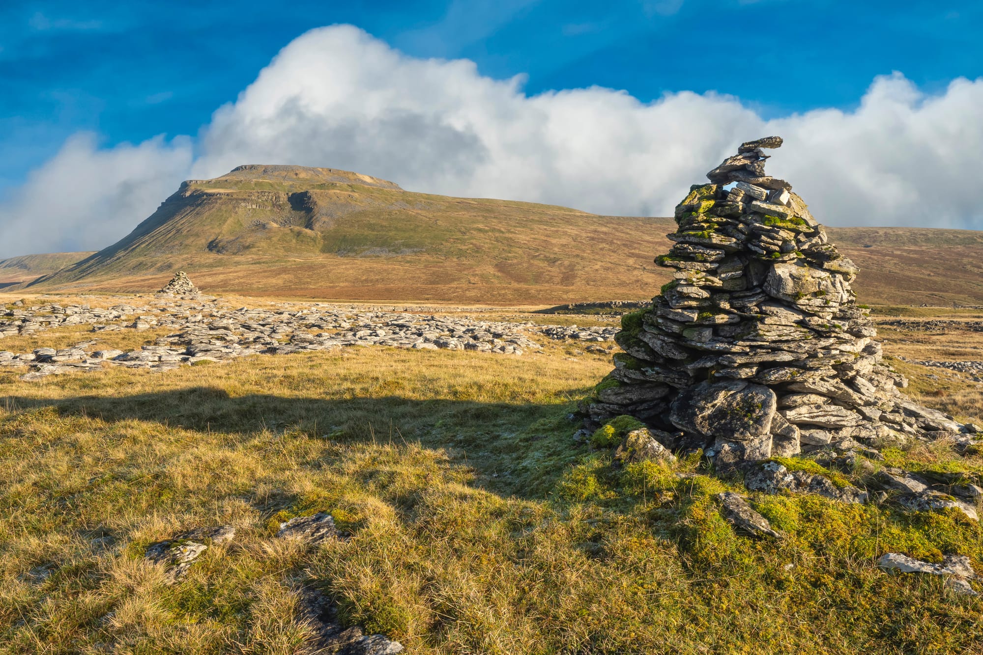
- Ingleborough Summit: At 723 meters, the summit offers spectacular views of Morecambe Bay, the Lake District, and the Dales, including Pen-y-ghent and Whernside.
- Limestone Pavements: Near the summit, the route features impressive limestone pavements, part of the Great Scar Limestone Group.
End Point: Tourist Information Car Park, Ingleton
Practical Information
Distance: Approximately 6 miles (9.6 kilometres)
Difficulty: Moderate – involves some steep sections and rugged terrain.
Terrain: Mixed terrain including grassy fields, rocky paths, and limestone pavements. Paths can be slippery and boggy, especially in wet conditions.
Access:
- By Car: Parking is available at the Tourist Information Car Park in Ingleton.
- Public Transport: Ingleton is accessible by bus from nearby towns, making it convenient to reach the start point without a car.
Gallery


Tips for Walkers
Footwear: Sturdy, waterproof walking boots are essential due to the rocky and sometimes muddy paths.
Supplies: Bring water, snacks, and possibly a packed lunch. Facilities for refreshments are available in Ingleton.
Navigation: Carry a map (OS Explorer OL2) and a compass, and know how to use them. A GPS device can be useful but should not be solely relied upon.
Weather: Be prepared for changing weather conditions, even in summer. Carry waterproof clothing, warm layers, and a hat and gloves.
The Ingleborough walk from Ingleton is a rewarding and scenic route in the Yorkshire Dales.
This 6-mile circular walk includes a climb to the summit of Ingleborough, offering breathtaking views and featuring fascinating limestone pavements.
Starting and ending in Ingleton, this walk is perfect for those looking for a moderate hike in one of the Dales' most iconic locations!